Dune Fine Beach House
108 Beach to Bay Drive, Cape San Blas, Florida, 32456
108 Beach to Bay Drive, Cape San Blas, Florida, 32456
Nearby Airports -
- Northwest Florida Beaches International Airport (ECP), Bay County, Florida - 1 hr 37 minutes, 73 miles
- Tallahassee International Airport (TLH), Tallahassee, Florida - 2 hrs 8 minutes, 102 miles
Dock Information

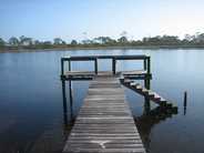
The community dock is located in the Saint Joseph Bay, in Pig Bayou, on the west side of Pig Island, 300 yards Southwest of the North tip of the island. The dock can be accessed by boat, depending upon the tide conditions and the type of boat.
To navigate a boat to and from the Community Dock, it is imperative to observe these tides and plan accordingly. There will be many weeks you can safely navigate during all tides and there will be some weeks when the low tide water depth will be too shallow for safe navigation. Water depth can vary by more than 3 feet.
The Saint Joseph Bay and the Gulf side of Cape San Blas experience Mixed Tides - Diurnal (1 high and 1 low tide/day) and Semi-Diurnal(2 high and 2 low tides/day). Depending upon the time of the year, the tides will be Diurnal for over a week and then change over to Semi-Diurnal for 1-3 days. This cycle will repeat over and over.
Free tide charts are available at Scallop Cove and The Trading Post on the Cape. In Port St Joe, free tide charts are available at Bluewater Outriggers and Half Hitch.
Here are 2 excellent websites that offer tide information for Port St Joe/Saint Joseph Bay:
WWW Tide and Current Predictor http://tbone.biol.sc.edu/tide/
Select US Gulf Coast (from east to east), then scroll down about half way down your screen to “Port St Joe, Saint Josephs Bay, Florida”. Scroll down and fill in your Prediction Options for the dates you want to see the tide data. The tides at the dock will be the same as at Port St Joe across the Bay. You can select text or graphic displays.
Swell Info (surfers website) http://www.swellinfo.com
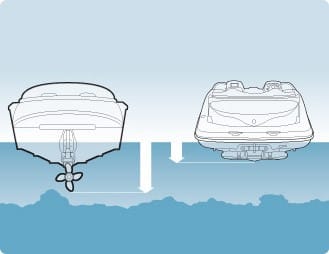
The draft of your boat (how deep the prop/foot of your motor is below the surface of the water), along with the tide water depth will determine if you can safely navigate to and from the Community Dock.
It would be wise to walk to the dock at low tide and physically measure the depth of the water around the dock with a marked dip stick (broom handle/crab net handle/etc.) Write the measurement down on the low tide data for that date on your tide chart. That will be your baseline for that day. REMEMBER…the low tide tomorrow may be lower than the one for today! Simple add or subtract the difference of the low tide values for all the other days, based on what your actual measured depth vs the posted low tide depth on the chart was for today!
Navigation -
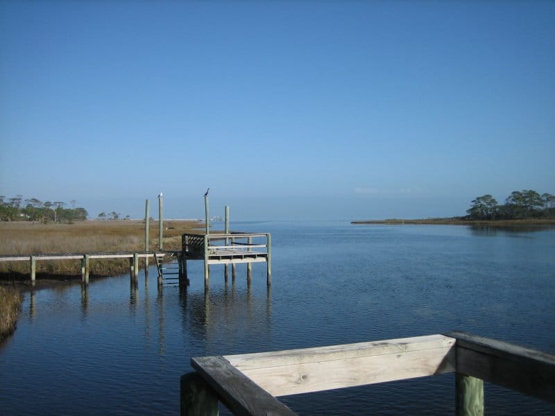
Best navigation course to and from the Community Dock is from the North. The tip of Pig Island is in this view. (This is an older picture and another dock has been built just north of the one next to the Community Dock.)
Best navigation course to and from the Community Dock is from the North. The tip of Pig Island is in this view. (This is an older picture and another dock has been built just north of the one next to the Community Dock.)
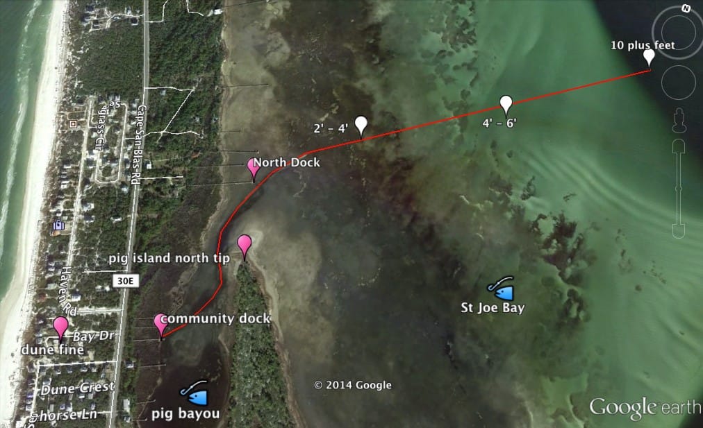
The Dock labeled “North Dock” (260 yards north of tip of Pig Island) is where a narrow channel begins, that leads into Pig Bayou and the Community Dock begins.
For GPS navigation:
The 10 foot plus marker is located at 29°43’02.47”N, -85°21’58.02”W (decimal, 29.71735, -85.36611).
The North dock coordinates are 29° 42’ 37.44”N, - 85°22’37.69”W (decimal, 29.71040, -85.37713).
The Community Dock is located at 29° 42’ 21.55”, -85°22’39.94”W (decimal, 29.70598N, -85.37776W).
Approach at idle speed from the 10 foot plus location with motor trimmed “UP” as high as operationally possible (water pump inlet must remain under the surface of the water)….monitor your water temp and/or outflow squirting stream! The water is usually clear enough to see the bottom all the way to the dock. Much of the bottom in Pig Bayou is a soft, silty, vegative and mud sand muck! You do not want to stand in it, as your feet will sink into the muck, much like a quick sand! Around the dock, the bottom is usually more stable.
Should your boat get trapped at an extreme low tide aground at the dock, do not panic. Your boat will simply rest on the soft bottom. Six to twelve hours later, the tide will rise again and your boat will float free!
Proudly powered by Weebly


